Tuesday, September 14, 2021

Hang Pagoda


Hang Pagoda seats on Sam mountain in Chau Doc city, offering a tranquil landscape and many legends to hand down. 

Sam Mountain in Chau Doc City is about 200 m high above sea level and has a convergence of many spiritual destinations and famous monuments such as Ba Chua Temple of Sam Mountain, Tay An Pagoda, Thoai Ngoc Hau Tomb. 

Located on Tan Lo Kieu Luong street, about 2 km from Tay An pagoda is Phuoc Dien pagoda, also known as Hang Pagoda. It was founded by Mrs. Tho (real name Le Thi Tho, born in 1818).


Sunday, September 12, 2021

Ha Giang Rice Fields


From Ha Giang City, you take about 3 hours to go to Vinh Quang Town, Hoang Su Phi District. After that, you drive another 30 km to Ban Phung Commune. The road to Ban Phung is bumpy and dangerous with many dangerous bends, but in return, the feeling of fatigue disappears when you see the rural houses of the La Chi people.

Sunday, August 22, 2021

Sapa


Sa Pa takes a lead in the most beautiful photo spots, according to the votes of global travelers on Booking.com. 

The latest survey was conducted by 20,934 respondents in 28 countries and territories, including 500 Vietnamese. Survey participants are of adult age, have traveled or worked in the past 12 months and have travel plans in the next 12 months. 

Top 10 most beautiful destinations, according to international visitors say that Vietnam's poetic scenery satisfies their passion for photography


Tuesday, August 17, 2021

Da Nhim


The photo depicts fanciful grassy hills in the mist in Da Nhim, Lac Duong, about 40 km east of Da Lat. 

In addition to losing green space, Da Lat is deserted this summer and the tourism industry is affected by Covid-19. As of the morning of July 31, Lam Dong province had 47 Covid-19 patients in 8 districts and cities. All gateways to the center of Da Lat city are locked and strictly controlled. 

There are no leisurely pedestrians, no hawkers in public places, and no tourist convoys running around Da Lat.

Saturday, August 14, 2021

Suoi Vang Dam


Golden sunshine reflects on the area of Suoi Vang Dam (or Ankroet Dam), surrounded by pine forest in Lac Duong district, about 15 km from Da Lat. 

This dam, built of split stone, 97 m long, 10 m high, is an indispensable attraction in the journey to discover Dan Kia - Suoi Vang valley. 

Visitors choose Da Lat as a place to visit, relax and enjoy the fresh, cold air. But now Da Lat is losing its green areas, from illegal exploitation of forest resources, and the cold in the plateau is also losing its specificity.  

When the city became crowded, some chose to go further to the suburbs to photograph the white misty plateau.

Da Sar in Dalat


White clouds float on pine hills in Da Sar, Lac Duong district, about 20 km from Da Lat. 

International and domestic tourists choose Da Lat as a must-visit place to relax and enjoy the fresh, cold air. But now Da Lat is losing its green areas, from illegal exploitation of forest resources, and the cold in the plateau is also losing its specificity.  

When the city became crowded, some chose to go further to the suburbs to capture photographs of the white misty plateau.

Vegetable Garden in Dalat

Vegetable garden in Xuan Tho commune in a morning full of dew and rays of sunshine through pine trees. In addition to losing green space, Da Lat is deserted this summer and the tourism industry is affected by Covid-19.  

As of the morning of July 31, Lam Dong province had 47 Covid-19 patients in 8 districts and cities. All gateways to the center of Da Lat city are locked and strictly controlled. There are no leisurely pedestrians, no hawkers in public places, and no tourist convoys running around Da Lat.

Pine Hill


Dawn on a pine forest and greenhouses in Tuy Son village, Xuan Tho commune. To have an opportunity for  you to capture painting-like photos, you have to wake up early at dawn, then up to 7 am is ideal period for taking photos.

Tuyen Lam Lake in Dalat


 One of the ideal places to hunt for dewing in Da Lat is in the flooded forest of Tuyen Lam Lake. This is the largest freshwater lake in Da Lat, about 7 km from the city center in the direction of National Highway 20 to Prenn Pass.  

A young photographer capturing the moment of a new day on Tuyen Tam lake brings an interesting feeling. A corner of the forest appears as beautiful as a painting, thanks to the early morning sunshining through the foliage. This is also the only flooded forest in Dalat.

Wednesday, August 11, 2021

Bai Tu Long Bay

Cruise programs often combine many outdoor activities such as exploring Thien Canh Son cave in Cong Do reserve on Bai Tu Long Bay. Visitors climb nearly 100 stone steps to reach the mouth of the cave. From there, they can see the corner of the bay surrounded by green trees.

In addition, many cruise ships have routes through Sung Sot cave, Sang Toi cave, and Titop island.
 

Thursday, August 5, 2021

Than Tho Lake in Dalat


A herd of gallant horses is grazing under the rays of the sun through the green pine trees at Than Tho Lake. 

This is a tourist attraction located in the middle of the wild pine forest, associated with the sad love story of "two grave pine hill", about 6 km from the center of Da Lat, along the road Quang Trung

Golf Course Cu Hill


Dalat is in middle of Covid-19 pandemic. Thus, all non-essential services have to be closed down. In such a situation, the golf course next to Xuan Huong lake, with a view of Da Lat PEdagogical College in the distance is deserted.  
 
Photos of the mountain town shows that Da Lat has less and less "green areas" when many buildings, restaurants, and hotels are in shade, and the city becomes more crowded. A regret for Dalat lovers.

Monday, July 12, 2021

Nam Cang - a Peaceful Sapa


At present, the Covid 19 pandemic has had the worst hit on Vietnam. Many localities have imposed the lockdown that has influenced upon the life of people.

Now, let's take a visual tour to Nam Cang, a peaceful Sapa, Vietnam to appease our boredom of isolation. 

Take the bus to Nam Cang on Friday night, spend the night in a house on stilts by the stream and trek. When Hanoi was in the midst of a long heat wave in July, our group took our backpacks to pick up the car to Nam Cang commune - the name is still unfamiliar to many people even though this place is only about 30 km from the center of Sa Pa.

In the local language, Nam Cang means watershed. This place is also the source of 3 big streams, Nam Cang, Nam Pa and Nam Thang deep in Hoang Lien Son National Park. As the last land in the southeast of Sa Pa district, the rhythm of life in the villages here is somewhat quieter and more peaceful. 

Nam Cang is almost isolated by the remote and bumpy road, although it is not far from the mountain town, it still retains its wild character. After about 5 hours of traveling in the morning, the group got off the bus and walked into a house on stilts in the Red Dao village. 

Instead of the "hello" and footsteps following guests like in Sa Pa, the children of Nam Cang welcomed us with crispy smiles on the way home from school, they were both playful and shy playing in the water by the stream. . 

From afar, only hearing the murmuring stream mixed with the sound of children playing, we felt all fatigue after a long journey. Stopping at the end of the village, we stayed at Topas Riverside Lodge, an isolated stilt house seats next to a large stream that everyone has to step over a swaying suspension bridge.

Monday, July 5, 2021

Rice Fields in Ta Pa


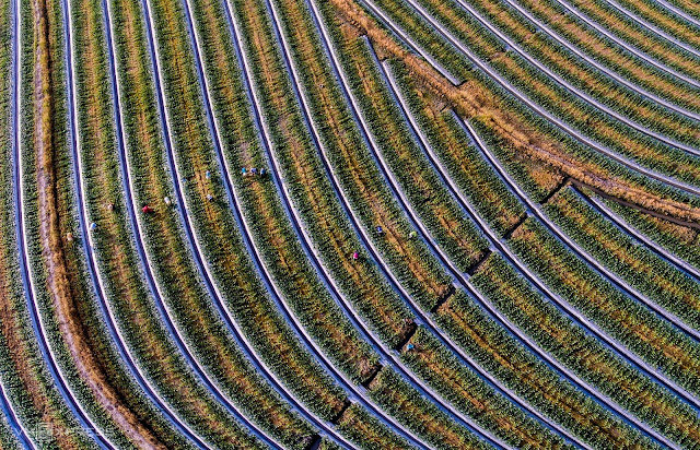
 The pieces of rice fields in Ta Pa are made up a beautiful painting full of the green and yellow color. 

Ta Pa Seen From Above


The main road that divides Ta Pa fields looks like a stretch of silk when you view from above. It leads to the end point of Soai Check lake. On the right of the road exists Ta Pa hill, and on the opposite side is Co To mountain, the second largest mountain in the Bay Nui region. This place belongs to That Son region - seven mountains in the Southwest Delta, in the territory of two districts of Tri Ton and Tinh Bien.

Monday, June 28, 2021

Herding Buffaloes

Le Hoang Thai (born 1979), a photographer, wandered on the roads to record beautiful scenes and rural rhythms of rural life in Long An Province. 
 
He is currently the chairman of the Moc Hoa District Photography Club. His collection of photos depicts the daily life and beauty of nature. Vam Co Tay is a river from Cambodia that flows through Long An territory with a length of more than 150 km and bends into many sections. Thanks to this natural condition, Long An forms an eco-tourism route from Tan Lap floating village to Floating pagoda and Lang Sen Wetland Reserve.

The author captures the scene of children herding buffaloes and playing kite flying in the field, an emotion coming back when remembering the verses: 

"My hometown is a blue kite

My childhood was flying in the field

My hometown is a small boat

Quiet water along the river" in the poem Homeland by poet Do Trung Quan.

Rhythm of Life


 Le Hoang Thai (born 1979), a photographer, wandered on the roads to record beautiful scenes and rural rhythms of rural life in Long An Province. 

He is currently the chairman of the Moc Hoa District Photography Club. His collection of photos depicts the daily life and beauty of nature. Vam Co Tay is a river from Cambodia that flows through Long An territory with a length of more than 150 km and bends into many sections. Thanks to this natural condition, Long An forms an eco-tourism route from Tan Lap floating village to Floating pagoda and Lang Sen Wetland Reserve. 
 
“I am passionate about photography, so every corner of the countryside and the rhythm of life in the seasons in my hometown are recorded, the most impressive of which is the daily life of people in the flood season. The photo above I took of the women who agreed to be a model for the scene of washing water lilies in the Tan Lap flooded plain, "said Mr. Thai.  
 
Flooding about September-October, the upstream districts of Long An province such as Moc Hoa, Tan Hung, Vinh Hung are flooded.  

Wednesday, June 23, 2021

Beds of Melons


Le Hoang Thai (born 1979), a photographer, wandered on the roads to record beautiful scenes and rural rhythms of rural life in Long An Province. 
 
He is currently the chairman of the Moc Hoa District Photography Club. His collection of photos depicts the daily life and beauty of nature. Vam Co Tay is a river from Cambodia that flows through Long An territory with a length of more than 150 km and bends into many sections. Thanks to this natural condition, Long An forms an eco-tourism route from Tan Lap floating village to Floating pagoda and Lang Sen Wetland Reserve.

The work "On the beds of melons" above captures the scene of farmers taking care of
 watermelons near Tet in Tan Lap.

Monday, June 21, 2021

Four-Season Beauty of Long An's River Area


Through the lens of photographer Le Hoang Thai, Tan Lap hometown becomes more poetic and colorful. 

Le Hoang Thai, born in 1979, in Hamlet 3, Tan Lap Commune, Moc Hoa District, Long An Province, likes to wander the streets to record beautiful scenes and rural rhythms, regardless of the rainy and sunny seasons. 

Thanks to this natural condition, Long An forms an eco-tourism route from Tan Lap floating village to Pagoda Noi and Wetland Reserve Lang Sen. Tan Tap Melaleuca forest is a famous eco-tourism destination of Long An, with charming river and melaleuca forests stretching as far as possible, especially in the spring, many flocks of storks fly back to perch on the Melaleuca forest.

You will have the feeling of peace when floating on the forest canal, enjoying the aroma of Melaleuca and watching the birds in the sky. 

The photo above depicts the painting of the countryside in the blooming season of  flowers in Tan Lap In spring, the tree sheds its leaves, flowers bloom in dense pink clusters on the branches and bear fruit in late April. 

This plant is associated with the childhood memories of the people of the South, and can be seen scattered along country roads, fields and riverbanks. 


Friday, June 18, 2021

Melaleuca Forest


Le Hoang Thai (born 1979), a photographer, wandered on the roads to record beautiful scenes and rural rhythms of rural life in Long An Province. 
 
He is currently the chairman of the Moc Hoa District Photography Club. His collection of photos depicts the daily life and beauty of nature. Vam Co Tay is a river from Cambodia that flows through Long An territory with a length of more than 150 km and bends into many sections. Thanks to this natural condition, Long An forms an eco-tourism route from Tan Lap floating village to Floating pagoda and Lang Sen Wetland Reserve. 
 
Tan Tap Melaleuca forest is a famous eco-tourism destination of Long An, with charming river.  Melaleuca forests stretches as far as the eye can see, especially in the spring, many flocks of storks fly back to perch on the Melaleuca forest. The scene would offer you a feeling of peace when you sail on the forest canal, enjoying the aroma of Melaleuca and watching the birds in the sky.

Discovering Coffee Culture in Hoi An

  A Journey Through Flavor and Tradition Hoi An, Vietnam, is famous not only for its ancient streets and lantern-lit evenings but also for a...